Land surveying is a process that takes place depending on different types of requirements.
The type of project that’s being undertaken, and the final goal it is what defines a land surveying project that is to be undertaken. For instance, issues with boundaries and encroachment might require a boundary survey.
Here are different types of land surveys and where they are used.
Types of Land Surveys and When Do You Need Them
While the land survey is usually a term that’s usually used in a generic manner, there are various types of land surveys that are conducted on a parcel of land, with different use cases in place. Here are different types of surveys and when they come into play.
1. Boundary Surveys
In a boundary survey, the land surveyors will do the basic work on a parcel of land, to determine where the boundary lines of the land. Moreover, if there are any buildings located around and structures in and around the land as well.
Uses: To determine the boundaries of the land in order to avoid disputes in the future.
2. Subdivision Surveys
Subdivision surveys are conducted when a piece of land has to be divided into smaller plots. With the help of a subdivision survey, the customers can follow the local government and zoning regulations. It also involves documenting the location of the land, mapping out property lines, and measuring distances.
Uses: Zoning regulations, street and drainage plans of a city, and measuring distances.
3. Topographic Surveys
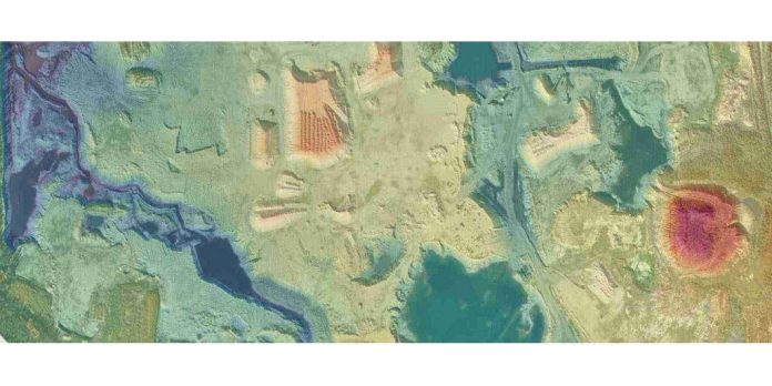
A topographic survey is conducted to determine the elevations, contours, and other characteristics of a piece of land above and below the surface as well.
The contour lines that are shown in the topographic survey depict the slope of the property. If the contour lines are closer, it means that the slope is steeper than usual. Similarly, if the contour lines are farther away than usual, the surface is flatter.
A topographic survey map might seem a little overwhelming to the layman, but a professional land surveyor can help customers understand it better.
Uses: Road and bridge construction, drainage systems, landscaping, etc
4. Site Plans
Site plans are drawings or blueprints which showcase the current plan and layout of the property improvements that have taken place and are completed. These can include, new buildings, driveways, parking lots, sidewalks, fences, and more.
A site plan also includes proposed improvements, instead of just the completed ones. A site plan needs to be approved before receiving a permit for commercial, institutional, industrial, or residential development.
Uses: Property improvements and upgrades
Conclusion: Make the Right Choice with The Best Land-Survey Geomatics Services
When choosing the right land survey company, it is essential to determine what the company’s expertise is, and how they operate.
There are various land survey companies that might have expertise in a single type of land survey-geomatics services, but not all of them.
However, with Core Geomatics, the customers get the right consultation depending on their requirements. No matter what the type of land survey is, their decades of experience come in handy, when conducting a survey. They provide top-quality land surveying services across Western Canada for residential, commercial, industrial, and energy projects.
Their advanced technologies and extensive knowledge in the field of land survey-geomatics services make them better than their competitors.
Know more about their services here.
For More Information about Calgary Land Surveyor and Real Property Reports Please Visit: CORE Geomatics.


